#Region  Project Attributes
    #ApplicationLabel: pci
    #VersionCode: 1
    #VersionName:
    'SupportedOrientations possible values: unspecified, landscape or portrait.
    #SupportedOrientations: unspecified
    #CanInstallToExternalStorage: True
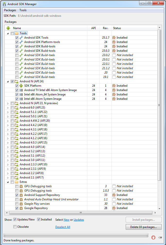
    '#AdditionalRes:H:\My Backup\ADT\extras\google\google_play_services\libproject\google-play-services_lib\res, com.google.android.gms
#AdditionalRes:H:\My Backup\ADT\extras\google\google-play-services\libproject\google-play-services_lib\res,com.google.android,gms
#AdditionalJar: com.google.android.gms:play-services-maps

#End Region

#Region  Activity Attributes
    #FullScreen: False
    #IncludeTitle: True
#End Region

Sub Process_Globals
    'These global variables will be declared once when the application starts.
    'These variables can be accessed from all modules.
    'map key = 'AIzaSyArj1Jvj-VfaGZLDg3TRE3yrdbfEI6AlZ8'
End Sub

Sub Globals
    'These global variables will be redeclared each time the activity is created.
    'These variables can only be accessed from this module.
    Dim spa As Spatialite_Database
    Dim spconstants As Spatialite_Constants
    Private ListView1 As ListView
    Private lbllat As Label
    Private lbllon As Label
    Private lblSatellites As Label
    Private WKBReader1 As JTS_WKBReader
    Private Panel1 As Panel
    Private Label_Details As Label
    Private Button_close As Button
    Private Map_panel As Panel
    Dim gmap As GoogleMap
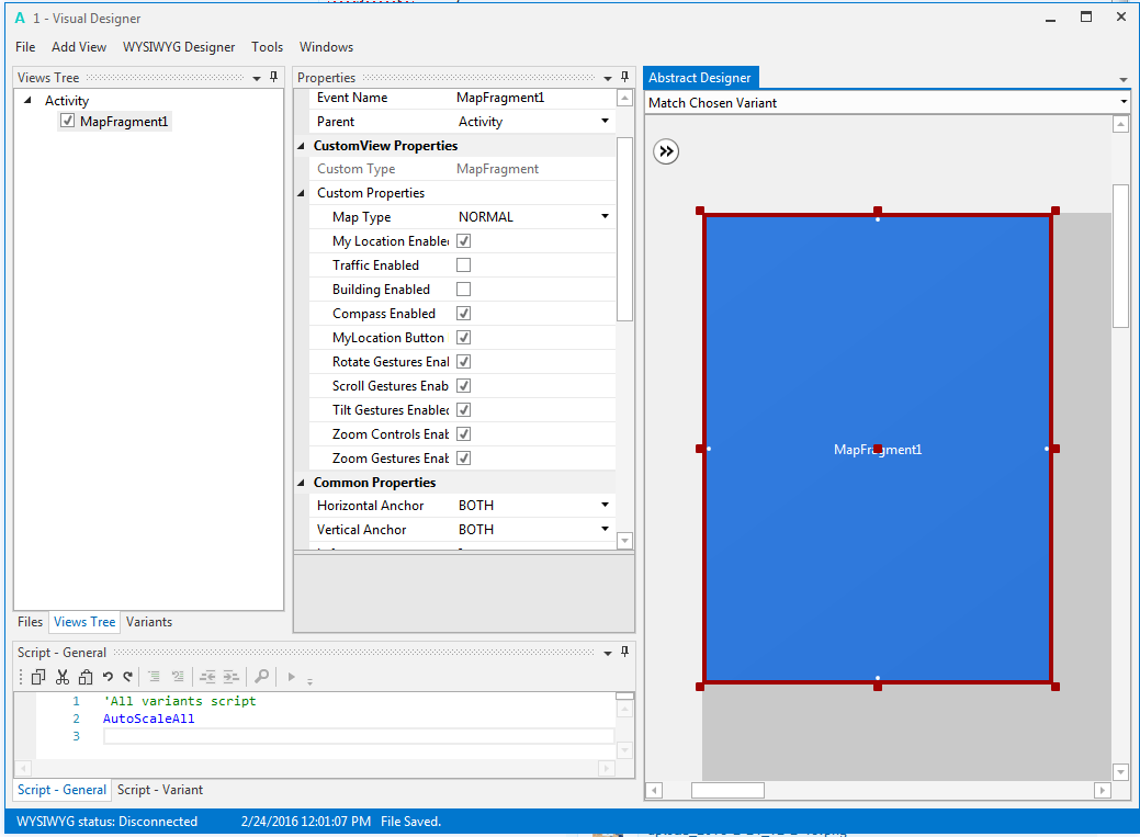
    Dim mFragment As MapFragment
End Sub

Sub Activity_Create(FirstTime As Boolean)
    'Do not forget to load the layout file created with the visual designer. For example:
    Activity.LoadLayout("Layout1")

    '  Map_panel.Initialize("")
   'Activity.AddView(MapPanel, 0, 0, 100%x, 100%y)
   If mFragment.IsGooglePlayServicesAvailable = False Then
      ToastMessageShow("Google Play services not available.", True)
'   Else
'      mFragment.Initialize("Map", Map_panel)
   End If

    If FirstTime Then
        spa.Initialize
        If File.ExternalWritable=True Then

                'If File.Exists(File.DirRootExternal, "veg1.db") = False  Then
                        File.Copy(File.DirAssets, "mm.sqlite", File.DirRootExternal, "mm.sqlite")
                'End If
                spa.Open(File.DirRootExternal, "mm.sqlite", spconstants.SQLITE_OPEN_READWRITE)
        Else

                'If File.Exists(File.DirInternal, "veg1.db") = False  Then
                        File.Copy(File.DirAssets, "mm.sqlite", File.DirInternal, "mm.sqlite")
                'End If
                'sql1.Initialize(File.DirInternal, "veg1.db", True)
                spa.Open(File.DirInternal, "mm.sqlite", spconstants.SQLITE_OPEN_READONLY)
        End If
        populate


    End If

    'spa.Open(File.DirAssets,"mm.sqlite",spconstants.SQLITE_OPEN_READONLY)
End Sub

Sub MapFragment1_Ready
   gmap = mFragment.GetMap
   Dim m1 As Marker = gmap.AddMarker(10, 30, "test")
   m1.Snippet = "This is the snippet"
End Sub

'Sub Map_Ready
'   Log("map ready")
'   gmap = mFragment.GetMap
'   If gmap.IsInitialized = False Then
'      ToastMessageShow("Error initializing map.", True)
'   Else
'      gmap.AddMarker(36, 15, "Hello!!!")
'      Dim cp As CameraPosition
'      cp.Initialize(36, 15, gmap.CameraPosition.Zoom)
'     ' gmap.AnimateCamera(cp)
'   End If
'End Sub
Sub populate
    'Dim sqlstring As String
'    sqlstring= "SELECT
    'Dim CountryNames As List
    Dim SpatialiteStatement As Spatialite_Stmt

    'CountryNames.Initialize
    SpatialiteStatement=spa.Prepare("SELECT ROAD_NAME, PKUID FROM DRRP_Roads where PCI is Null ORDER BY ROAD_NAME ASC")
    Do While SpatialiteStatement.Step
        ListView1.AddTwoLines2(SpatialiteStatement.ColumnString(0),SpatialiteStatement.ColumnInt(1),SpatialiteStatement.ColumnInt(1))

    Loop
    SpatialiteStatement.Close
'    Return CountryNames

End Sub

Sub Activity_Resume
    If Starter.GPS1.GPSEnabled = False Then
        ToastMessageShow("Please enable the GPS device.", True)
        StartActivity(Starter.GPS1.LocationSettingsIntent) 'Will open the relevant settings screen.
    Else
        Starter.rp.CheckAndRequest(Starter.rp.PERMISSION_ACCESS_FINE_LOCATION)
    End If
End Sub

Sub Activity_Pause (UserClosed As Boolean)
CallSub(Starter, "StopGPS")
End Sub

Sub Activity_PermissionResult (Permission As String, Result As Boolean)
    If Permission = Starter.rp.PERMISSION_ACCESS_FINE_LOCATION Then
        If Result Then CallSub(Starter, "StartGPS")
    End If
End Sub

Public Sub GpsStatus (Satellites As List)
    Dim sb As StringBuilder
    sb.Initialize
    sb.Append("Satellites:").Append(CRLF)
    For i = 0 To Satellites.Size - 1
        Dim Satellite As GPSSatellite = Satellites.Get(i)
        sb.Append(CRLF).Append(Satellite.Prn).Append($" $1.2{Satellite.Snr}"$).Append(" ").Append(Satellite.UsedInFix)
        sb.Append(" ").Append($" $1.2{Satellite.Azimuth}"$).Append($" $1.2{Satellite.Elevation}"$)
    Next
    lblSatellites.Text = sb.ToString
End Sub

Public Sub LocationChanged(Location1 As Location)
    lbllat.Text = "Lat = " & Location1.ConvertToMinutes(Location1.Latitude)
    lbllon.Text = "Lon = " & Location1.ConvertToMinutes(Location1.Longitude)
    'lblSpeed.Text = $"Speed = $1.2{Location1.Speed} m/s "$
End Sub

Public Sub Listview1_ItemClick (Position As Int, Value As Object)
    Dim id As Int=Value
    Dim txt As String = ""
    Dim SpatialiteStatement As Spatialite_Stmt

    'CountryNames.Initialize
    SpatialiteStatement=spa.Prepare("SELECT ROAD_NAME, ROAD_ID,RD_LENGTH, ASTEXT(Geometry) FROM DRRP_Roads where PKUID =" & id)
    Do While SpatialiteStatement.Step
        txt=SpatialiteStatement.ColumnString(0) & CRLF
        txt =txt & "Road ID:" & SpatialiteStatement.Columnint(1) & CRLF
        txt =txt & "Length(Km):" & SpatialiteStatement.ColumnDouble(2) & CRLF
        txt =txt & "Latlon:" & SpatialiteStatement.ColumnString(3) & CRLF
        Label_Details.Text=txt
    Loop

    SpatialiteStatement.Close
    Panel1.Visible=True

'    Dim pl As Polyline = gmap.AddPolyline
'      Dim l1, l2 As LatLng
'      l1.Initialize(30, 30)
'      l2.Initialize(40, 30)
'      Dim points As List
'      points.Initialize
'      points.Add(l1)
'      points.Add(l2)
'      pl.points = points
End Sub

Sub Button_close_Click
    Panel1.Visible=False
End Sub


